


Shipping:
Free Shipping Included
Delivery:
Estimated 2-15 Business Days
Payments:
Credit Card, Check, Cash, PayPal, Apple Pay, Venmo
Returns:
30 Days 100% Money Back Guarantee, Buyer Pays Return Shipping
Description
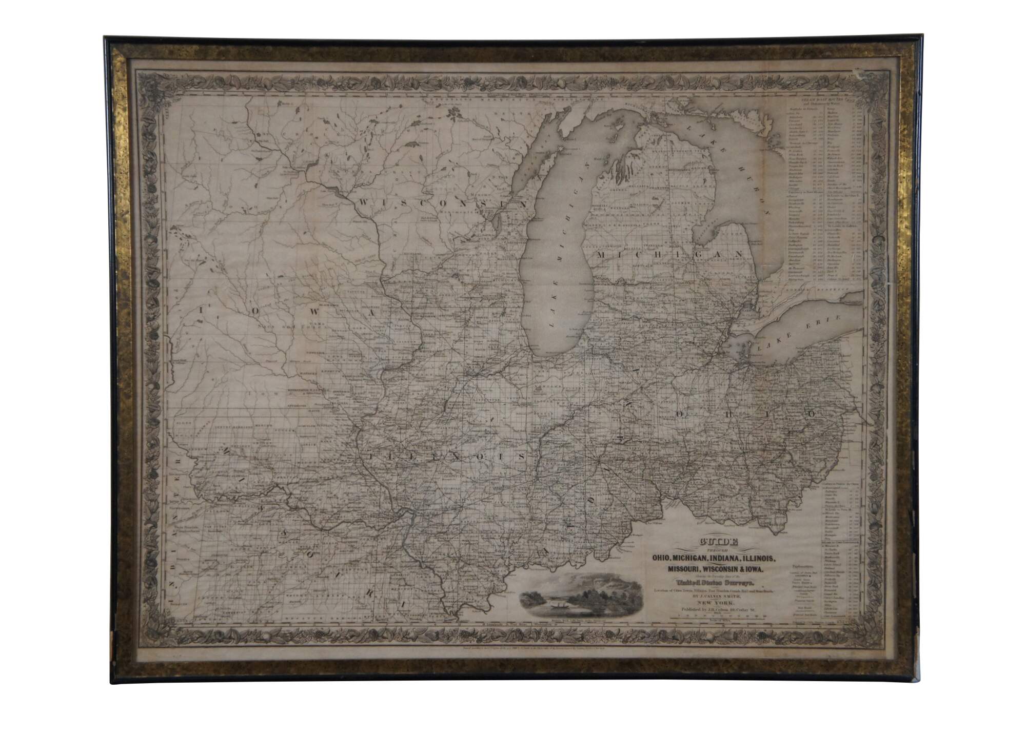
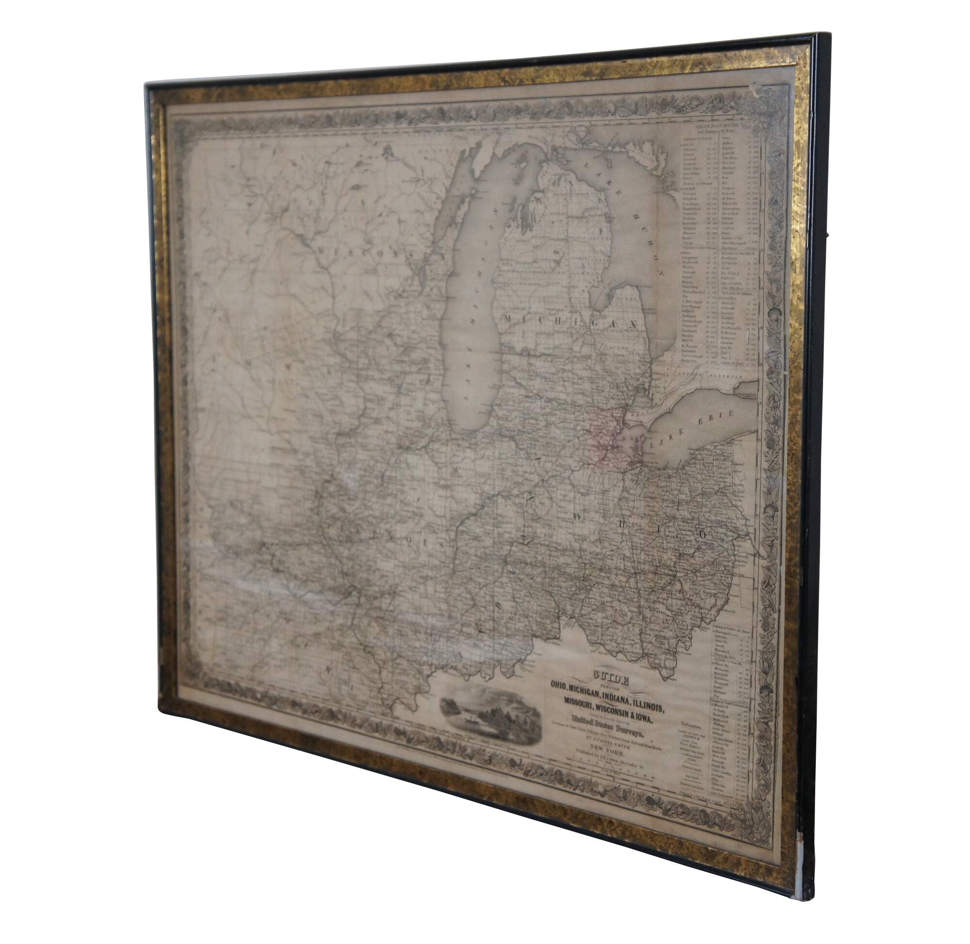
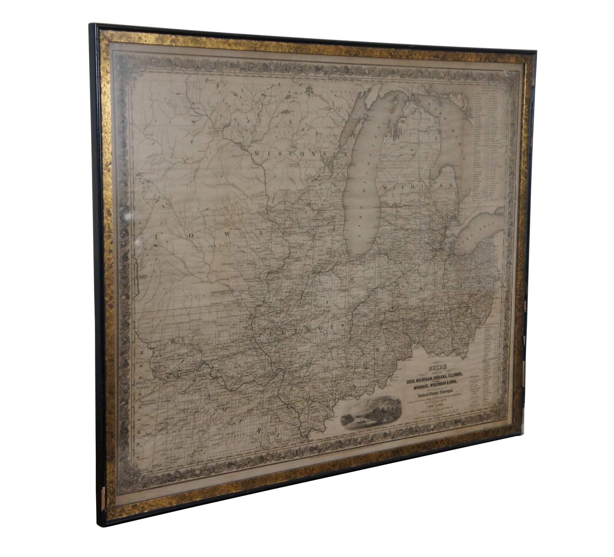
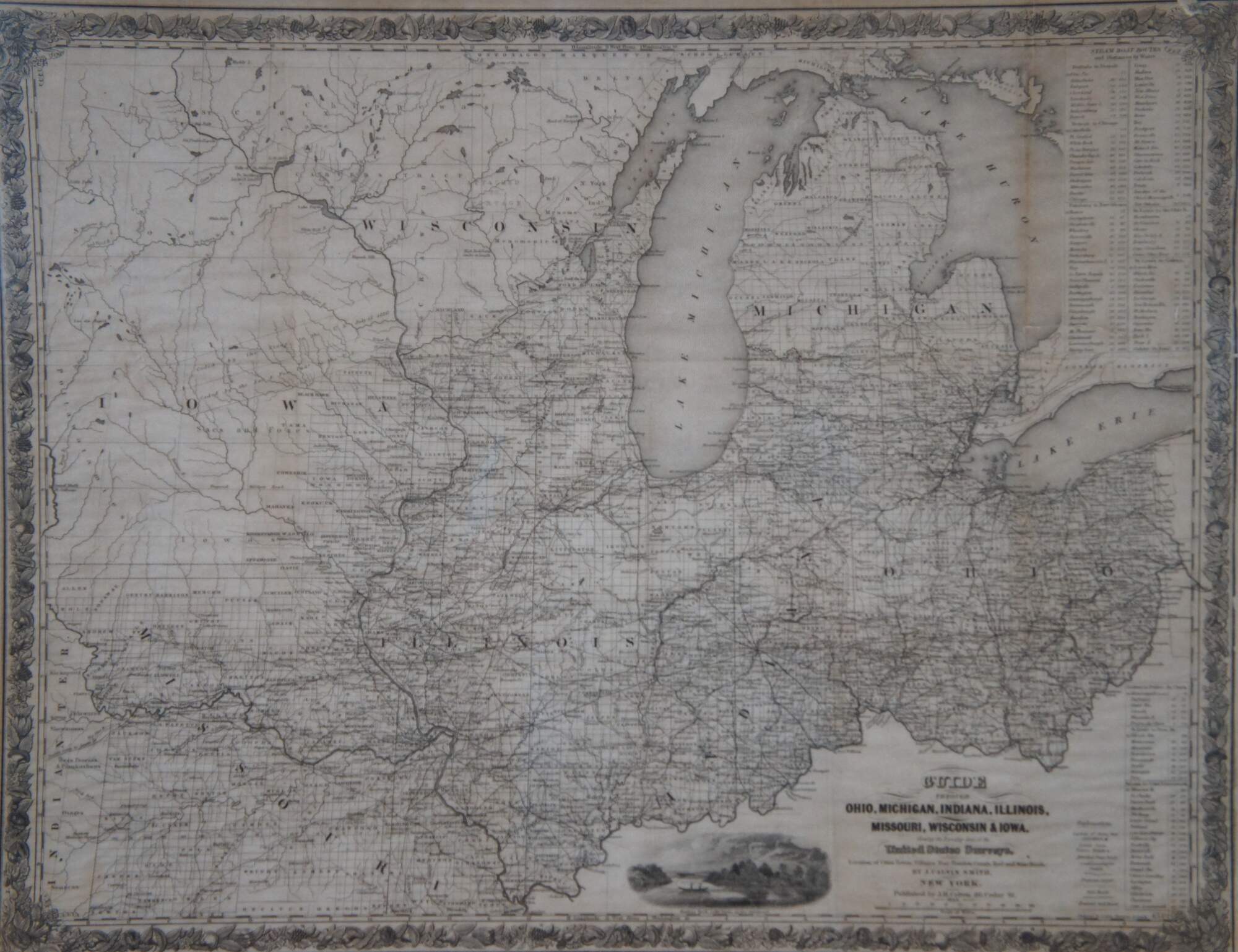
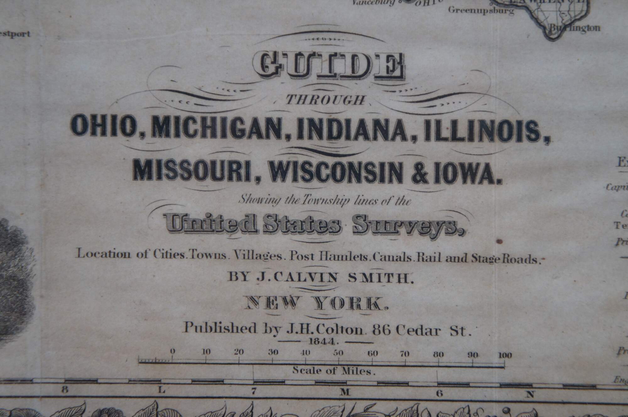
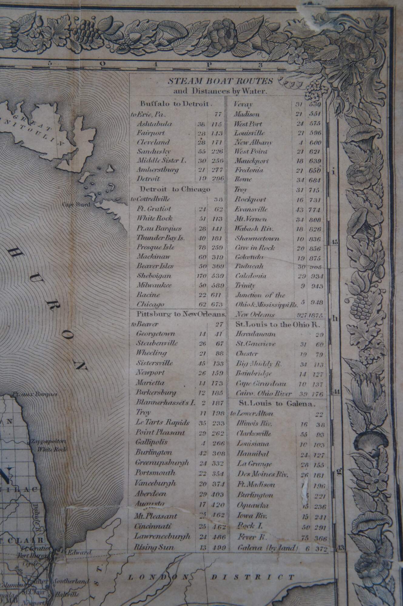
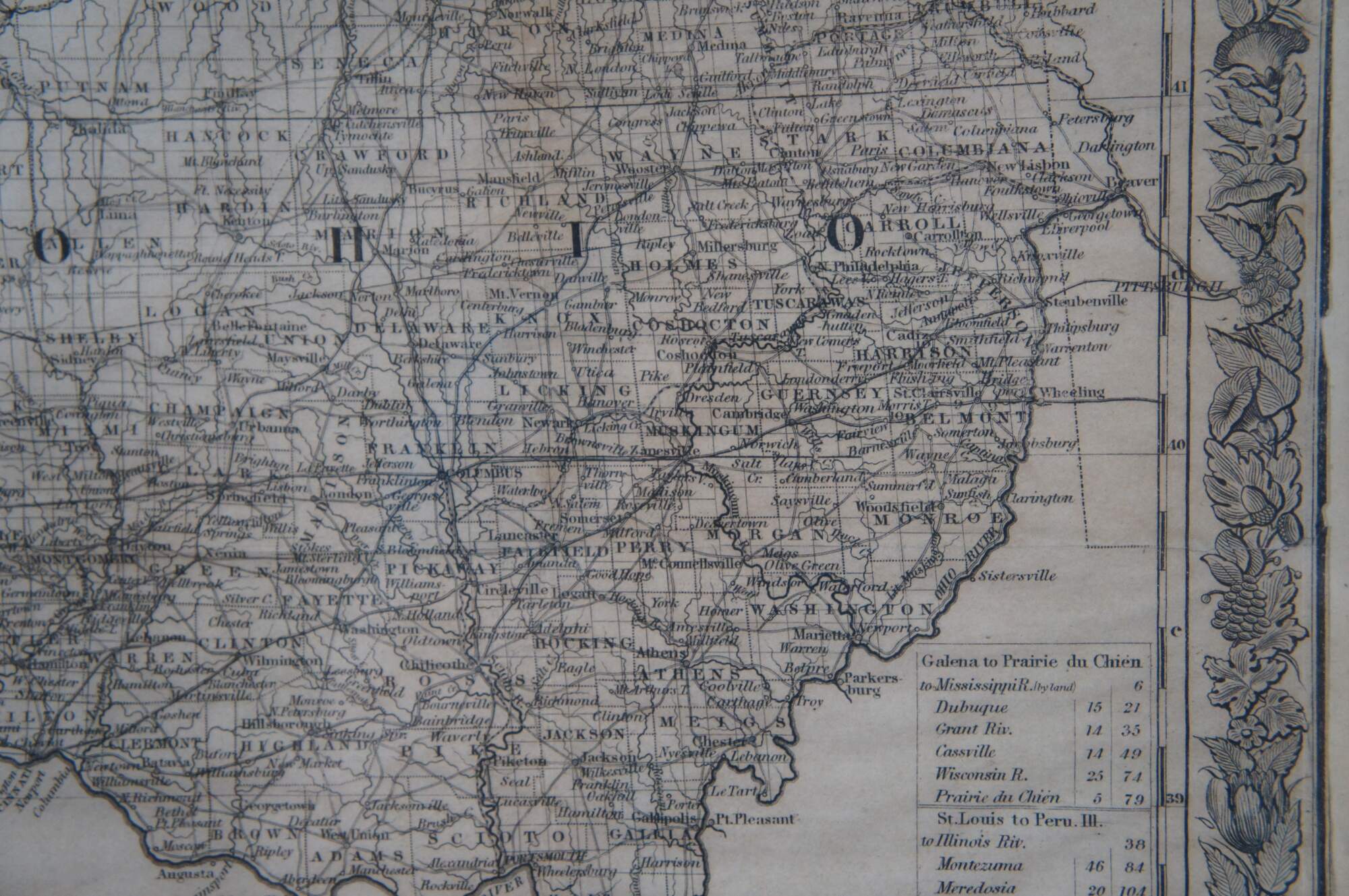
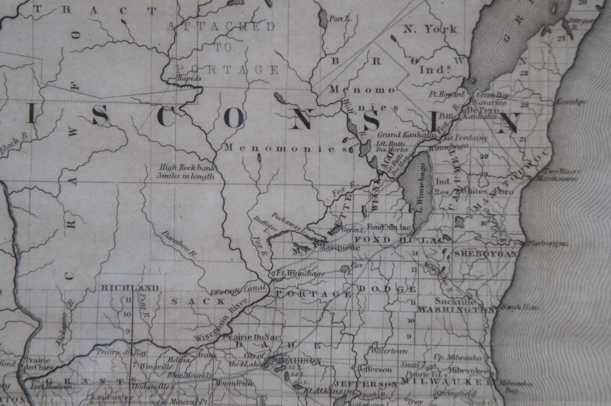
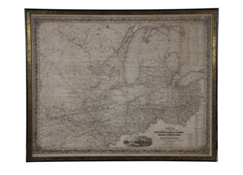
Antique framed black and white map of seven Midwestern American states. Guide Through Ohio, Michigan, Indiana, Illinois, Missouri, Wisconsin, & Iowa. Showing the Township Lines of the United States Surveys, Location of Cities, Towns, Villages, Post Hamlets, Canals, Rail and Stage Roads.
This striking cartographic map of the area known today as the Midwest was issued by John Calvin Smith and published by J.H. Colton in New York. It was tipped into the back of a small travel guide titled “The Western Tourist and Immigrants Guide,” also published by Colton and included with the map.
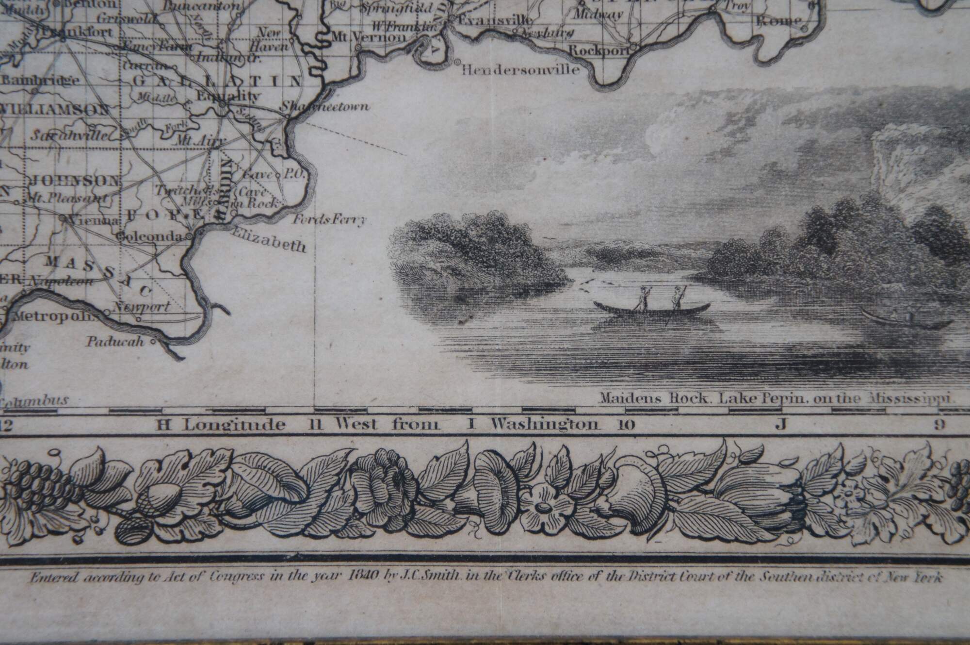
The map would have been a useful tool for the myriad of European immigrants who were moving to the United States in vast numbers throughout the mid-19th century. The states of Illinois, Indiana, Michigan, Ohio, Wisconsin, Iowa and Missouri are all displayed, with their respective transportation routes in the forms of railroads, canals and roads a focal point of the image. Distribution of surveyed counties and townships reflect the general pattern of westward settlement along these routes. Distance tables on the right side show various lengths of routes between popular destinations via water and land, while a decorative view at the bottom shows Maiden’s Rock on the tranquil Mississippi. The map provides a fascinating glimpse at how the U.S. promoted itself during the rush of immigration in the 19th century. Colton published several updated editions of this map through the late 1860’s.
Condition
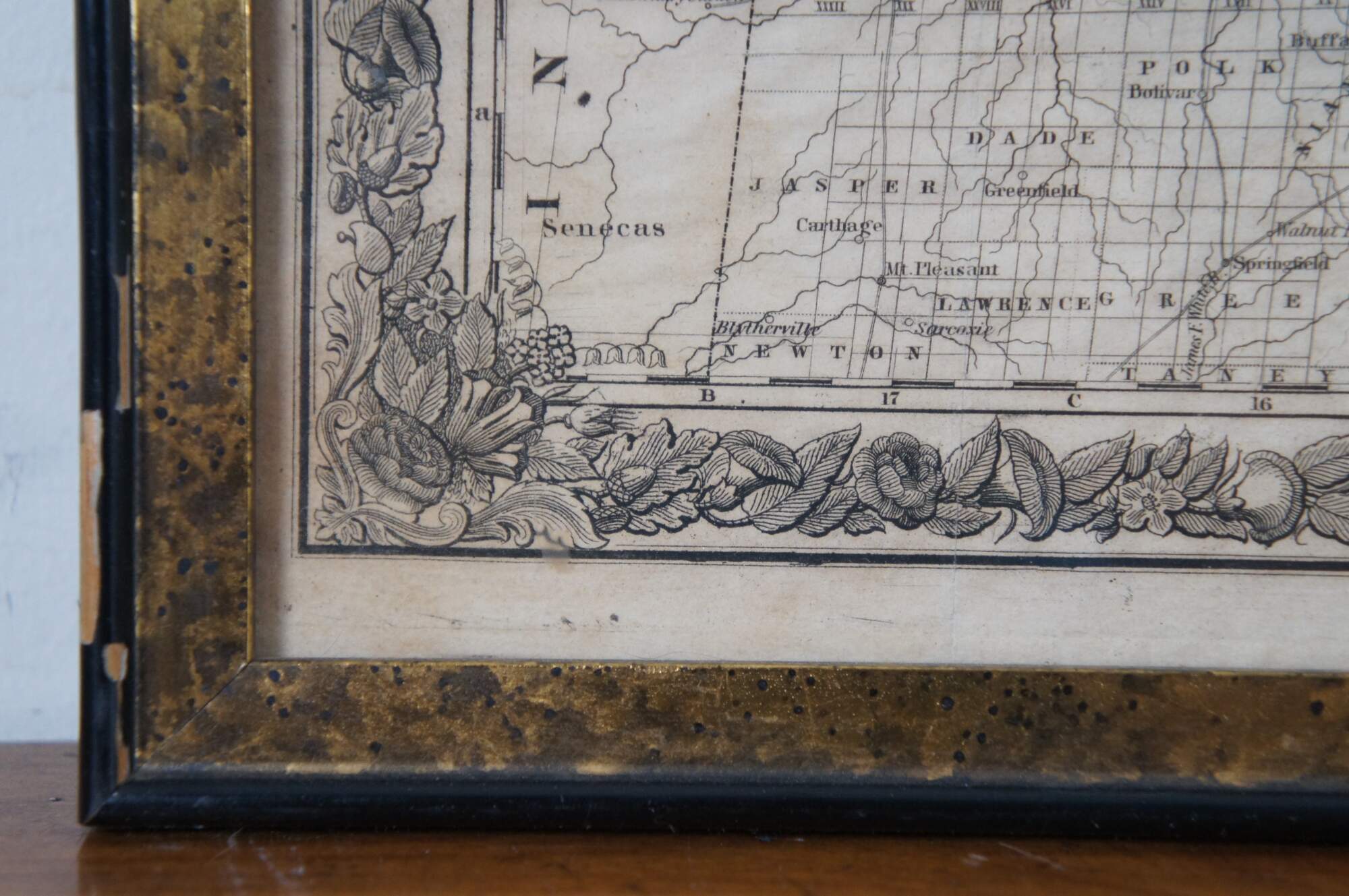
Good Overall - Gentle wear to frame; Some discoloration to map
Dimensions
26.5” x 0.5” x 21” / Sans Frame - 25” x 19.5” (Width x Depth x Height)